February 12, 2018
Cañón del Chicamocha
Today I am embarking on one of this trip’s epic journeys, not that I would really have been aware of the magnitude of the trip until it was well underway. I plan on hiking to the town of Jordan in the Chicamocha canyon, which seems easy enough, based on the location of the town relative to Barichara on the map, and the breezy assessments of some locals in town who don’t think the walk will take all-too-long. Never mind not taking seriously the risk factor of hiking alone into the wilds of the highlands of Colombia …
Barichara to Villanueva
Barichara to Villanueva
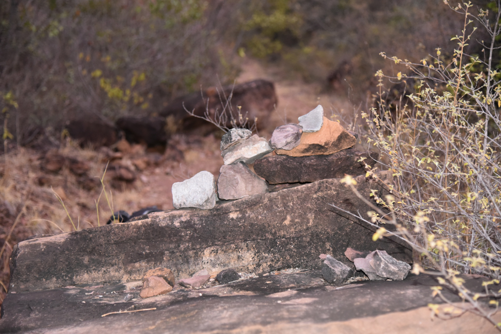
The walk takes me from the fringes of Barichara to the village of Villanueva to the northeast, then beyond to the lip of the canyon. On high ground, despite having been told there is some sort of walking trail, I end up following the road so as to avoid getting completely lost, not that there is any kind of traffic on the local road. The trail leading down the wall of the canyon is likely to be part of the Camino Real, part of a network of trails built by a German immigrant in the 19th century to promote trade in Santander, of which the trail to Guane I took yesterday plays a part.
Barichara to Villanueva
Barichara to Villanueva
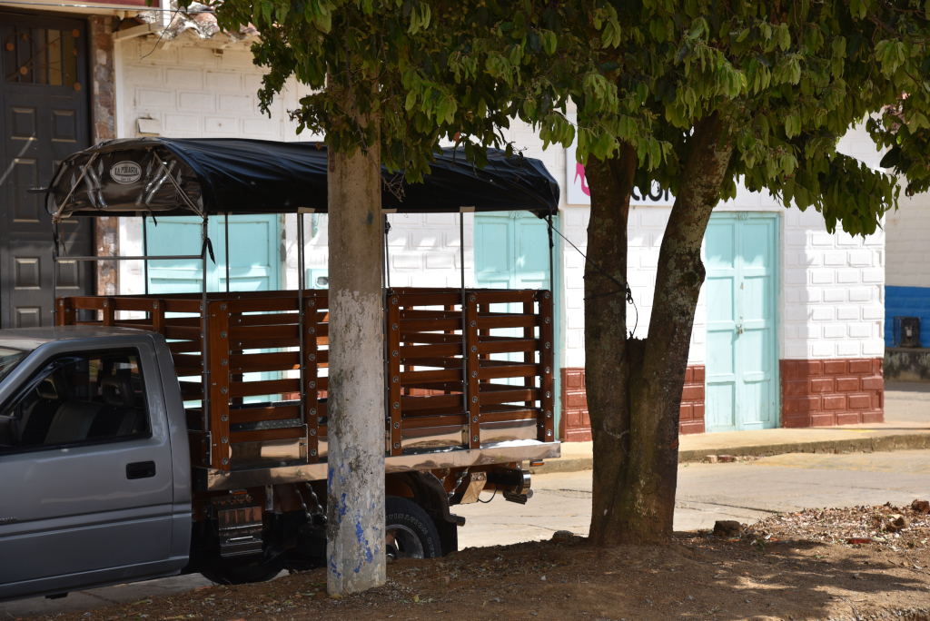
My trusted day pack is filled with the necessities I imagine will sustain me on the adventure into the Chicamocha canyon, although the worry always exists that not I may miss something crucial and not be able to compensate when I land in said remote area. On the other hand, having to walk the entire route precludes carrying too much. I leave me large pack and the bulk of my belongings with the owners of the house I stayed at in the lower portion of town, a place that in the end was perhaps not perfect, but its was redeeming in terms of its modernity, functionality and cleanliness, never mind privacy. The stay in Barichara felt both bucolic and lonely, the town more of a place you would come to with family or in romantic entanglement, but not on your own.
Barichara to Villanueva
Barichara to Villanueva
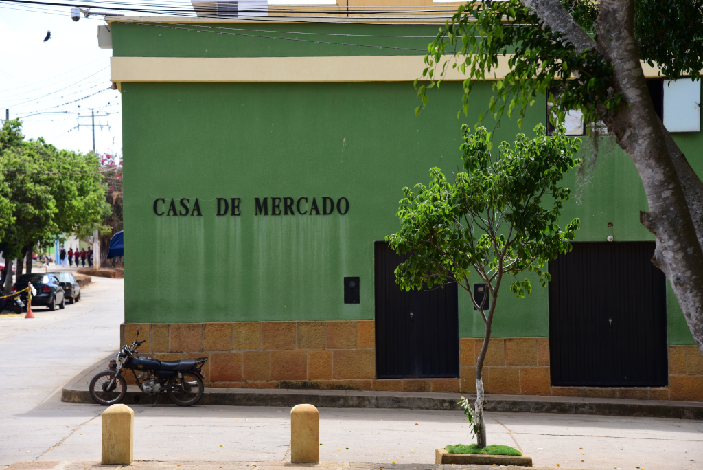
My backpack safely stowed against the wall of the owners’ ramshackle living room on the main floor of the house, I trudge up the hill towards the main plaza and beyond, through the largely empty streets of this gorgeous town, the sun shining brilliantly, the rambling one- and two-level white stucco structures of town crowned with symmetrical terracotta tiling, flowing into relatively opulent and more modern villas in the northeastern quadrant of town, despite the small-town character the level of luxury reflecting some of the most inflated real estate prices outside of the few big cities in the country.
Barichara to Villanueva
Barichara to Villanueva
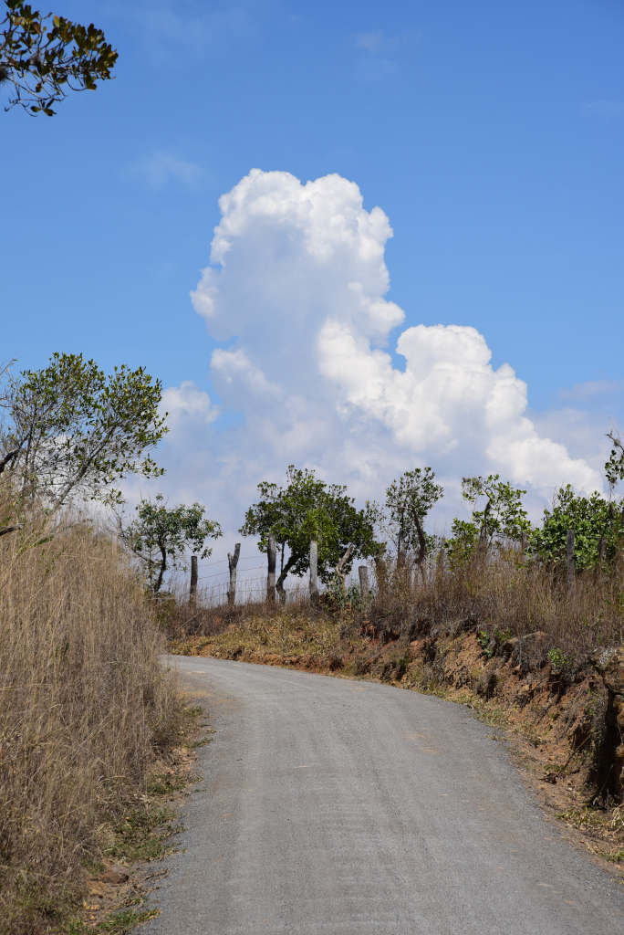
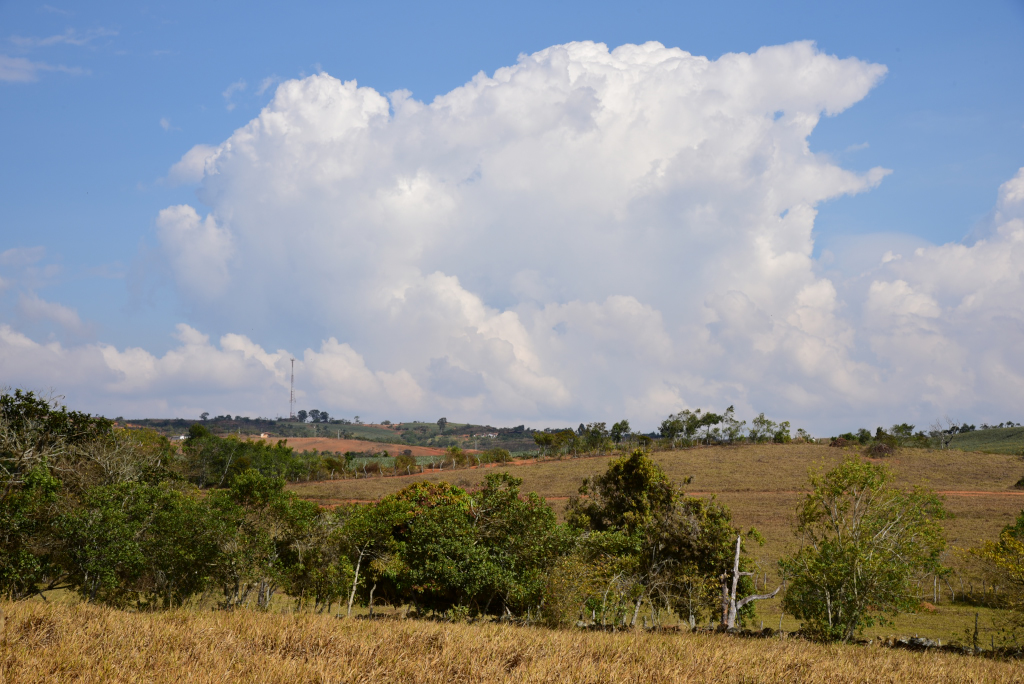
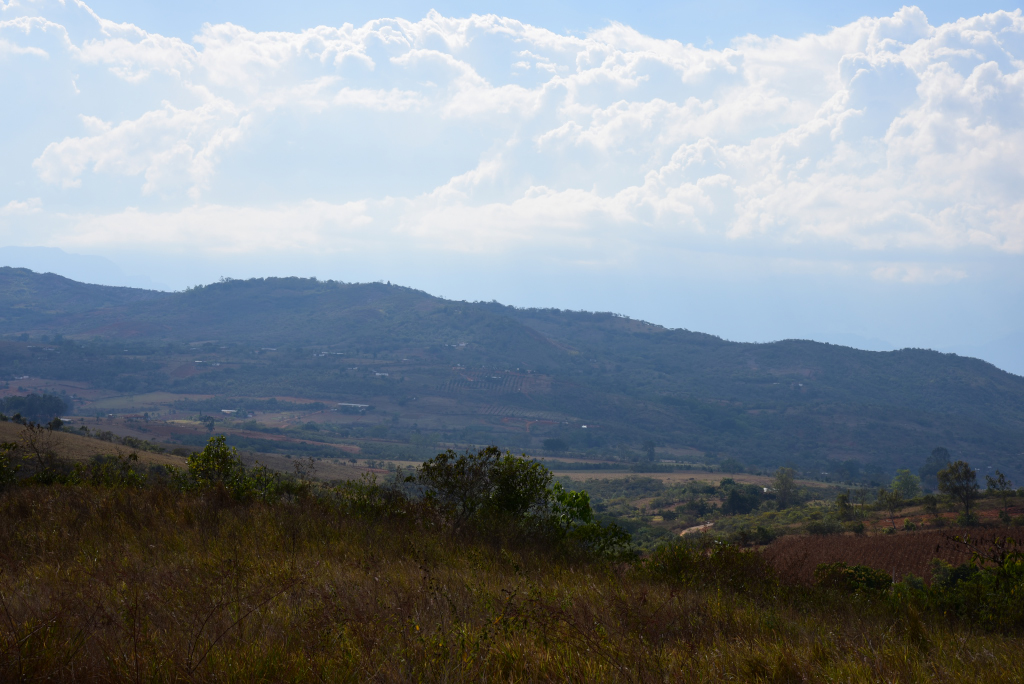
And quickly, I am outside of Barichara, walking along a dusty paved road that eventually will resort to a mineral-rich burnt ochre. I look for the promised trail apparently geared for walkers heading towards the canyon, although have seen no turnoff from the main road yet. The main road is really more of a narrow country lane winding its way through the fields and rolling hills of the central Santander highlands. Then I am loath to wander off on some random whim, given that I started out far later than I was supposed to have (huge surprise!), and there is moreover no one to check in with, given how abandoned the countryside seems. Colombia may be a busy country in its big cities, but the countryside is relatively sparsely populated, and however thin the population may be hereabouts, people will probably have other things to do than assist the random backpacker deciding to make his way on some off-beat country outing.
Barichara to Villanueva
Barichara to Villanueva
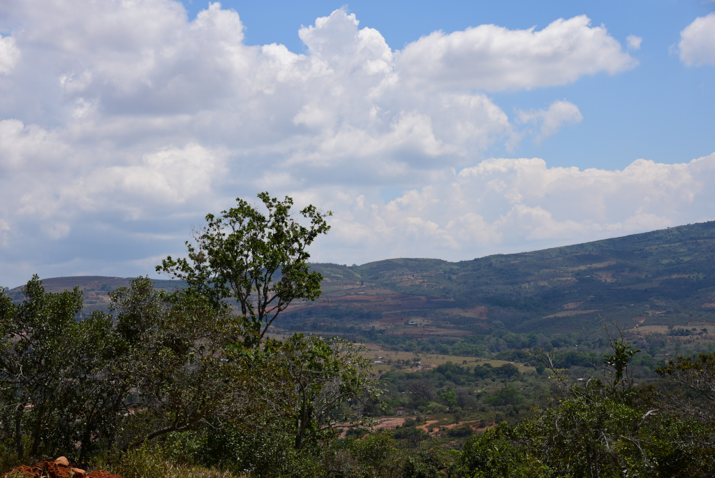
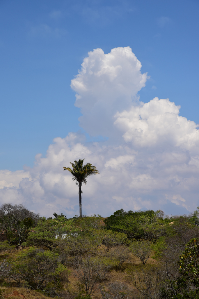
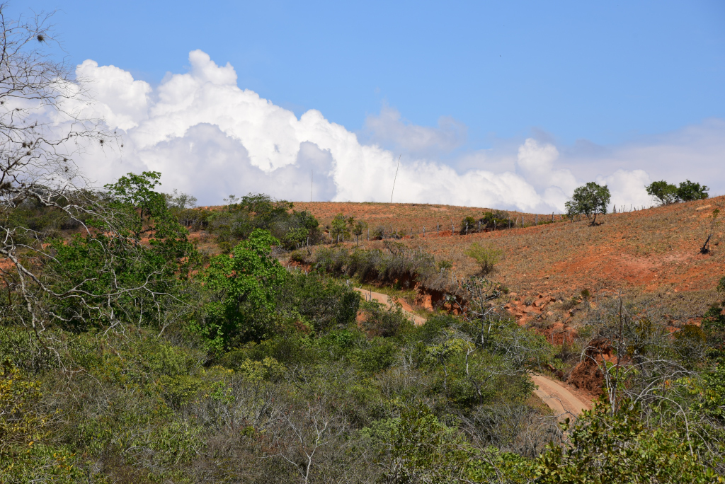
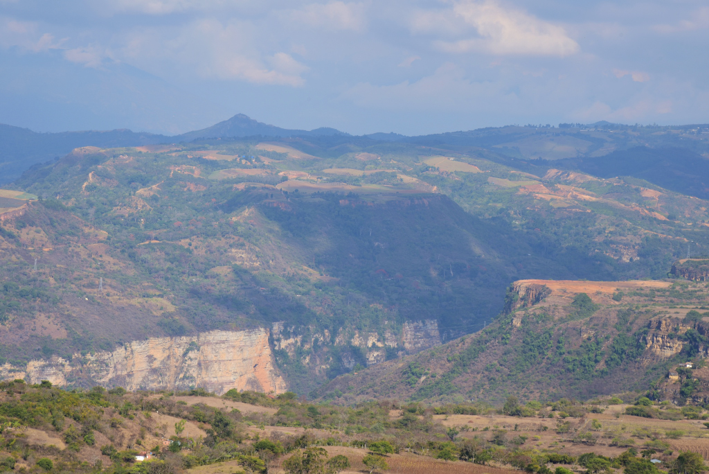
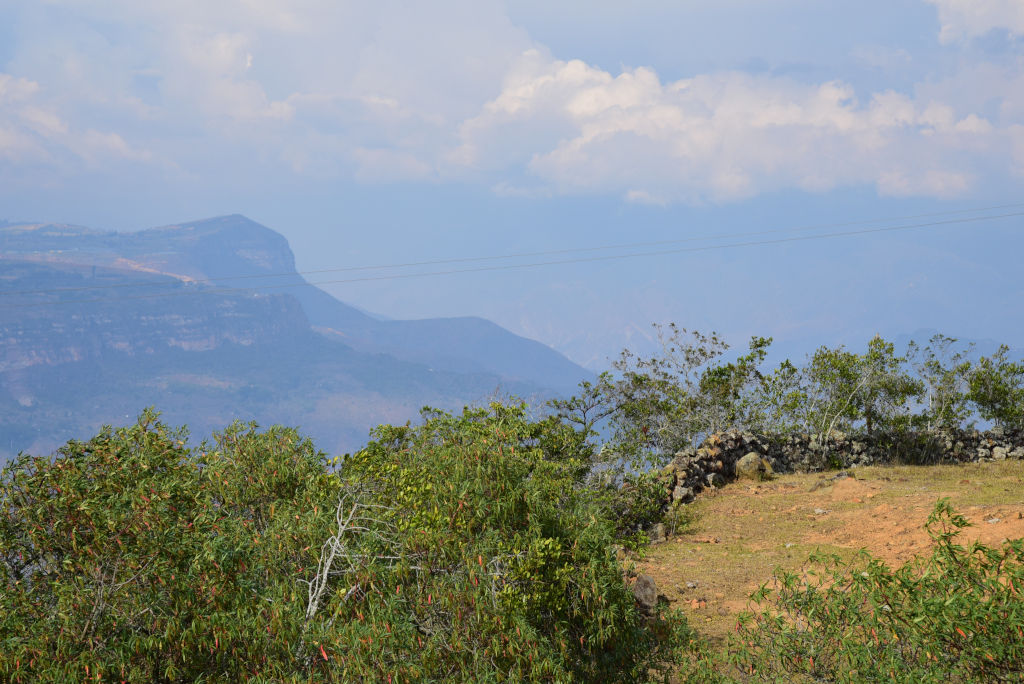
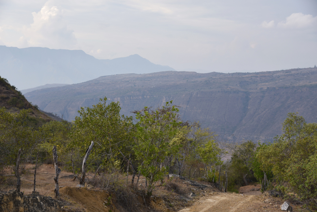
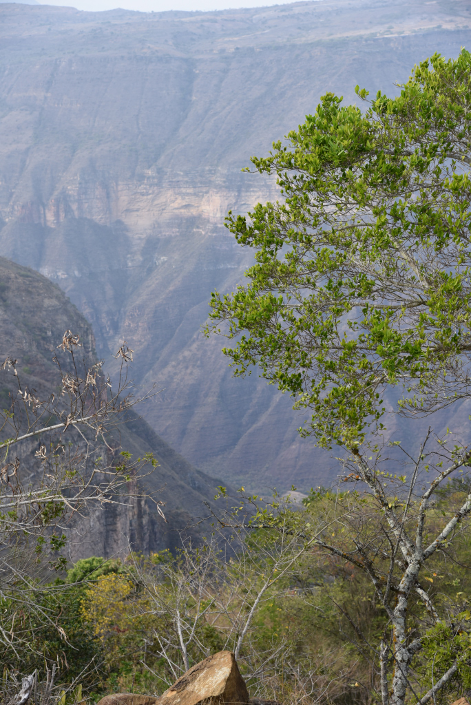
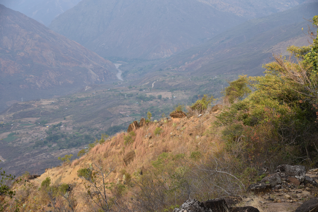
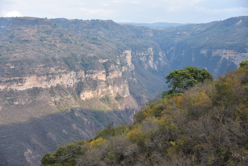
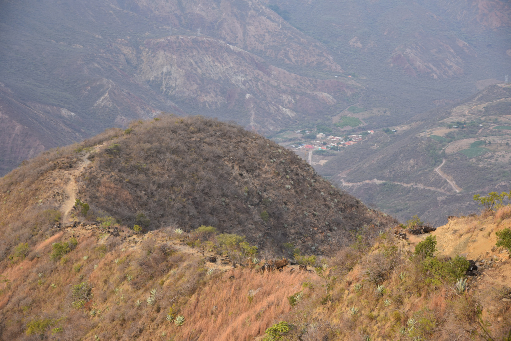
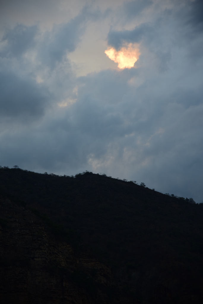
The landscape around me is dramatic, rich in green scrub and patchwork agriculture, and yet bereft of any organized cultivation, perhaps because the land is not suitable to crops, perhaps because the land is worth too much due to its proximity to Barichara, or perhaps abandoned due to historical political instabilities. The sky above is a brilliant blue, with no trace of rain in sight, only the occasional tufts of white cumulus draped somewhere across the horizon. But in a country with as plentiful and sudden rain as Colombia, it may be very naive to simply wander out in the countryside with the belief that a day that begins dry will stay dry. And yet today I am fortunately saved from the threat of torrential downpours: the sky remains blue, with nothing more than the occasional cloud, the image of perfect spring weather.
Barichara to Villanueva
Barichara to Villanueva
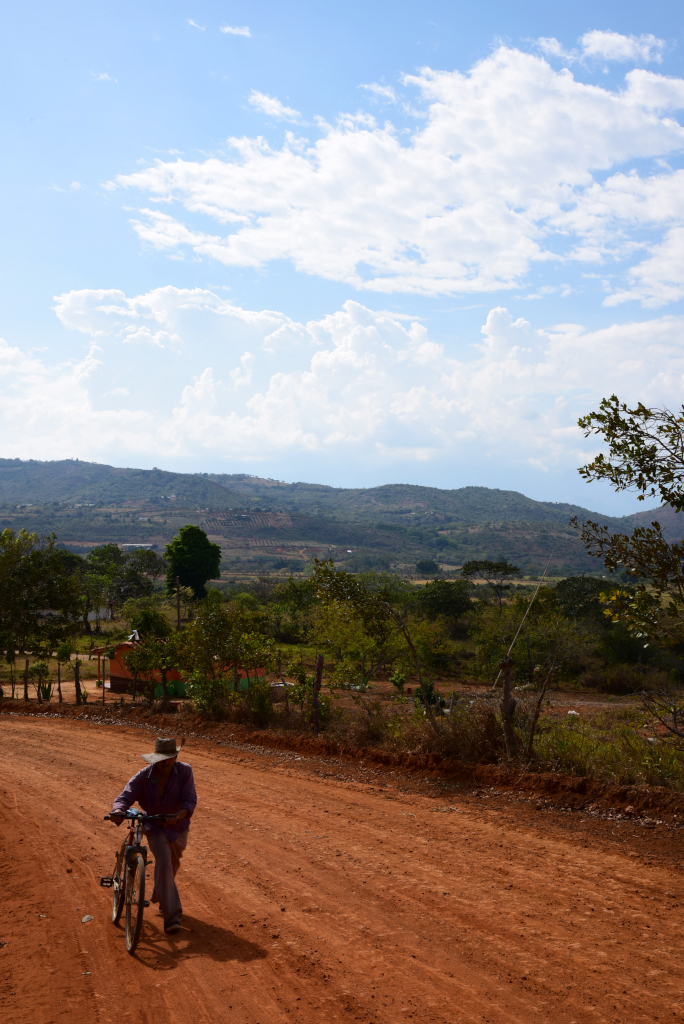
The broken, narrow pavement finally gives way to the tawny earth itself, the dusty soil whipped into a frenzy with occasional gusts of winds, then nothing but solitude, the absence of any living, breathing creature, human or otherwise. Nothing but my footsteps, one after the other, and the rustle of leaves around me. On rare occasion, a motorcyclists rambles by who I flag down and frantically ask if I am really on the path to Vilanueva. I am greeted with a mixture of astonishment and confusion. Yes, the road goes to Villanueva – where else do you think it would go to? But what could this gringo possibly want on the road to Villanueva?
Villanueva
Villanueva
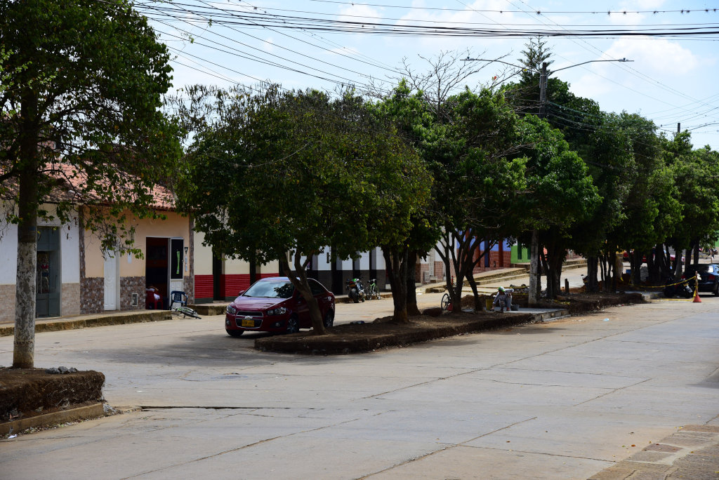
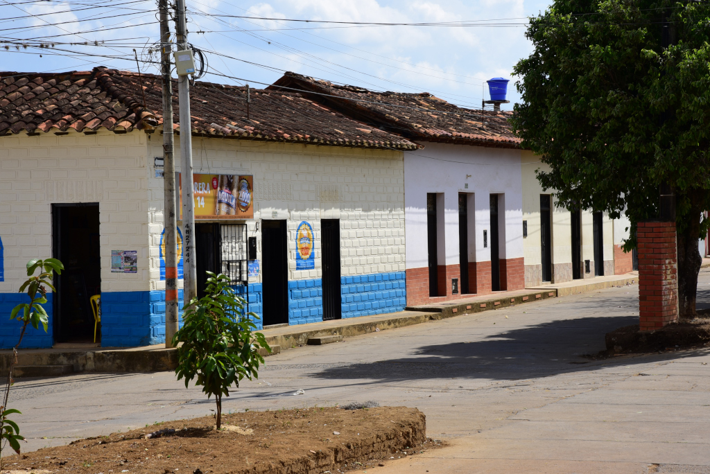
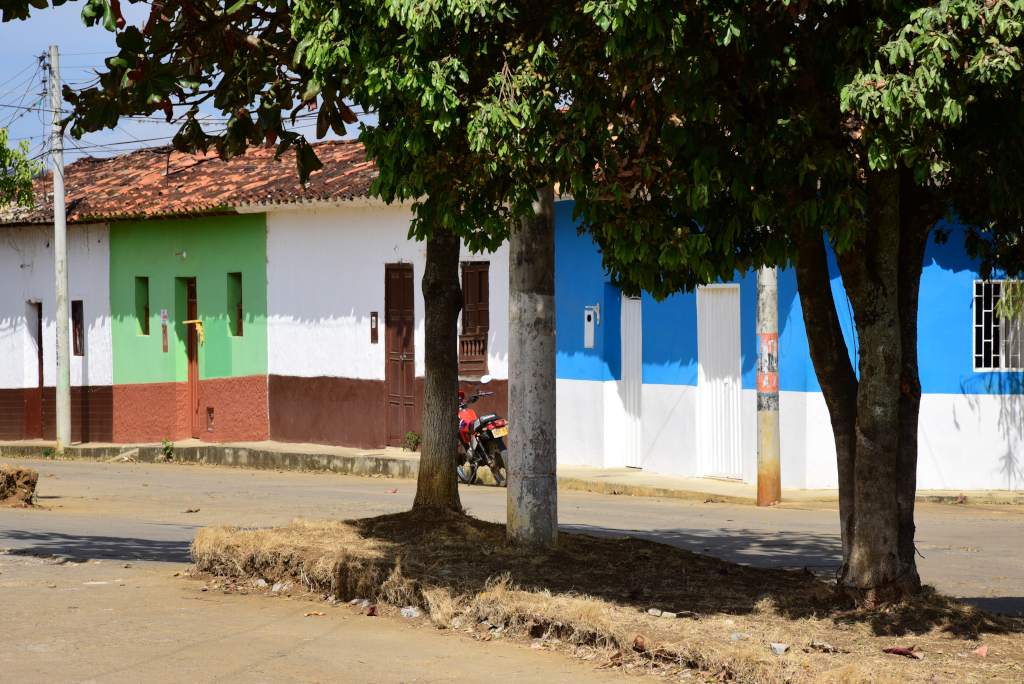
And there it is, finally, the small settlement that emerges as I rise above the swell, then vanishes, then reappears again, closer and less grainy, a grid of modest roads, the broken pavement lined with mostly single-level stone houses, rectilinear doorways and windows cuts from the flat surfaces to reveal small shops or homes, locals eyeing me with curiosity, the sensibility somewhat warm and welcoming, but not in any way overwhelming. Here as elsewhere in the world people are generally warmer at lower elevations, while passions tend to cool off at higher elevations. In fact, my experience at the higher elevations in Colombia is that locals are downright cold and mistrusting.
Villanueva
Villanueva
Villanueva
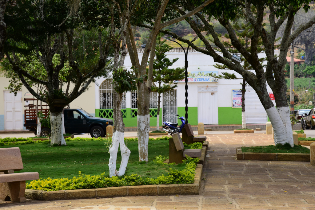
Along the central boulevard, the occasional vehicle passes, be it a car, motorcyclist or cyclist, stone benches flanking the undulating trunks of small trees planted along the grassy meridian running through the centre, a very civilized touch even in a modest hamlet such as this. In the central blocks, buildings reach a statuesque two levels, stores featuring glass windows, carefully organized displays and sizable selections of merchandise. On a side road running perpendicular from the main road, a cavernous eatery with no embellishments to speak other than a set of modest plastic tables and chairs beckons me for an inexpensive and yet satisfying lunch, the last food I’ll be eating until late at night.
Villanueva
Villanueva
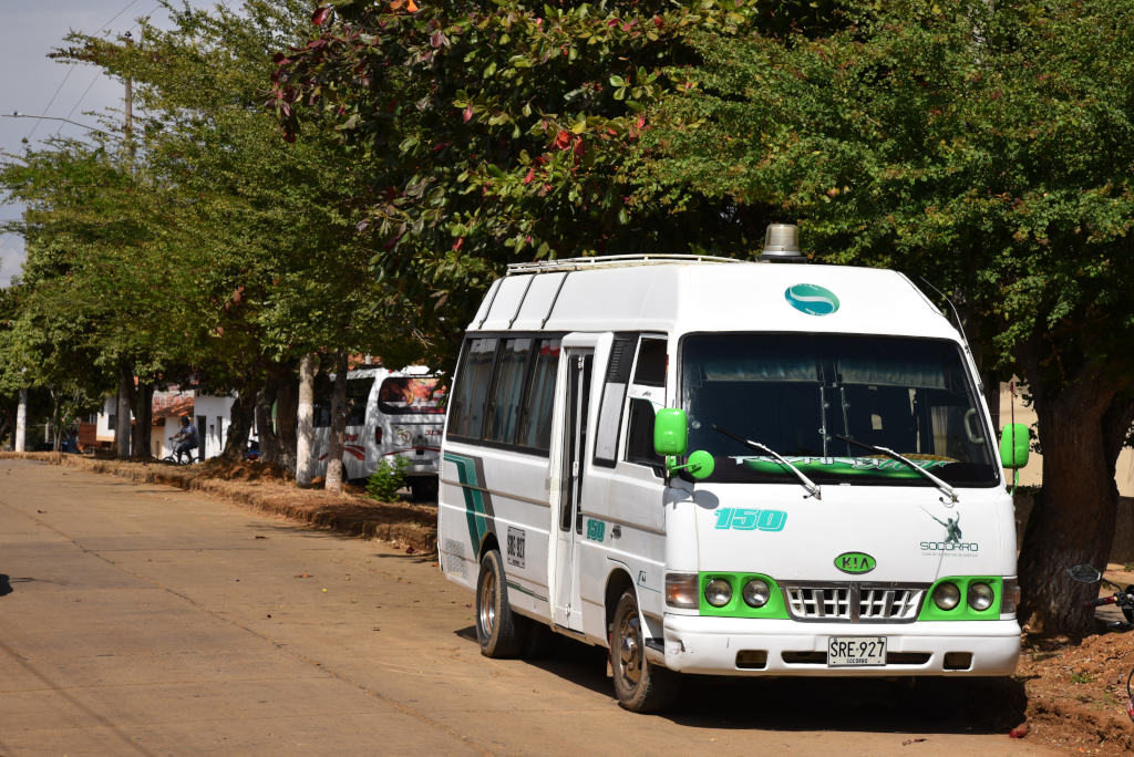
I see busetas parked along the street, but they wouldn’t be traveling to Barichara, rather to San Gil, which is the central transportation nexus of the region. They are of no use to me, as my trip isn’t originating – or ending – in San Gil. And then I’m off again, into the sprawling expanse of the countryside, presumably heading towards the town of Jordan, with little idea as to the challenges involved in actually getting there.
Villanueva
Villanueva
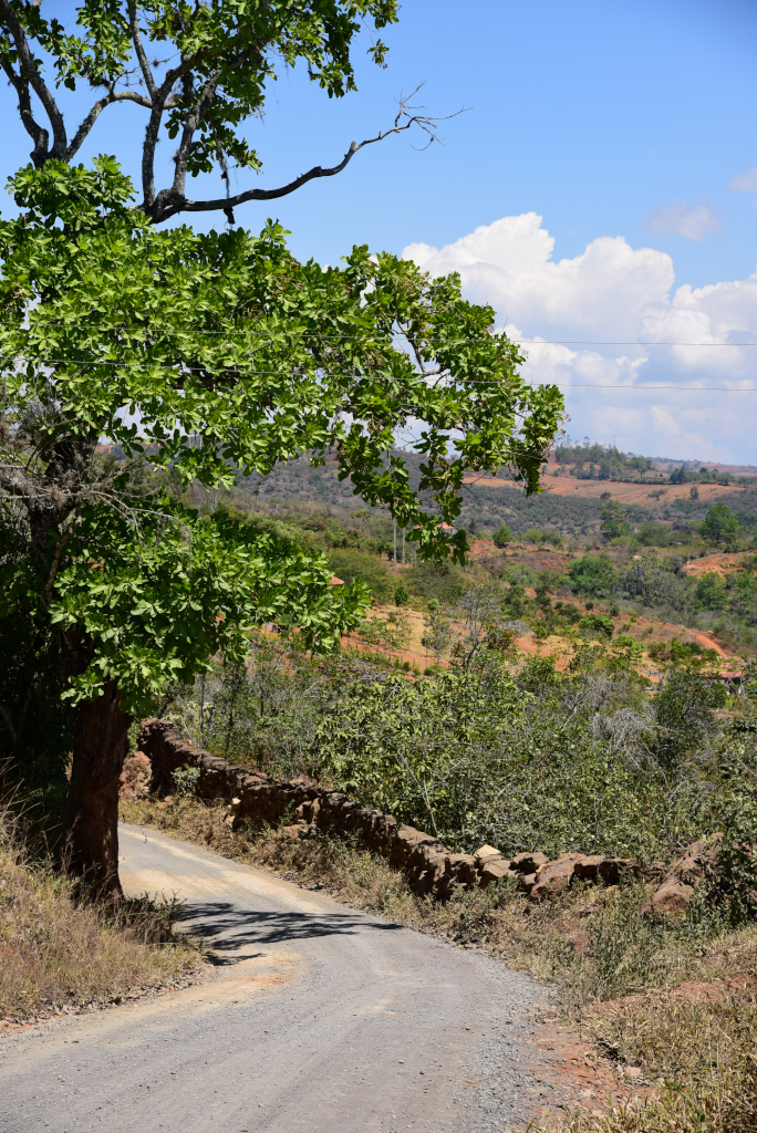
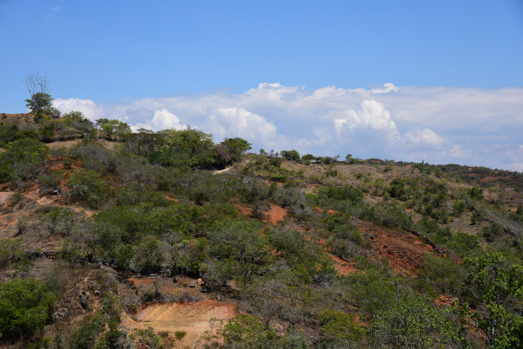
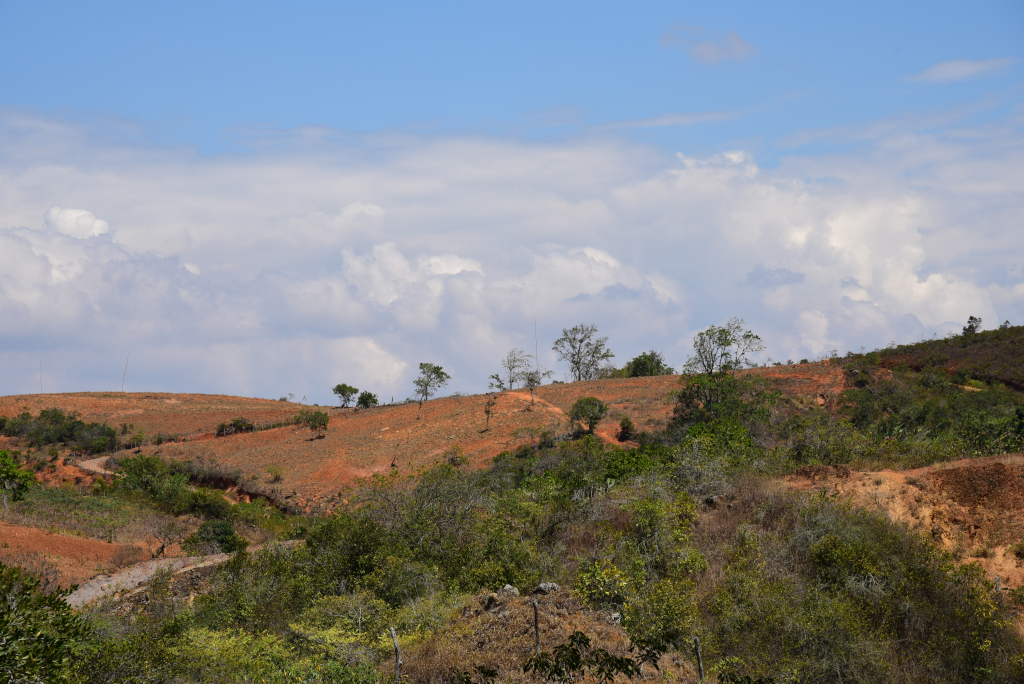
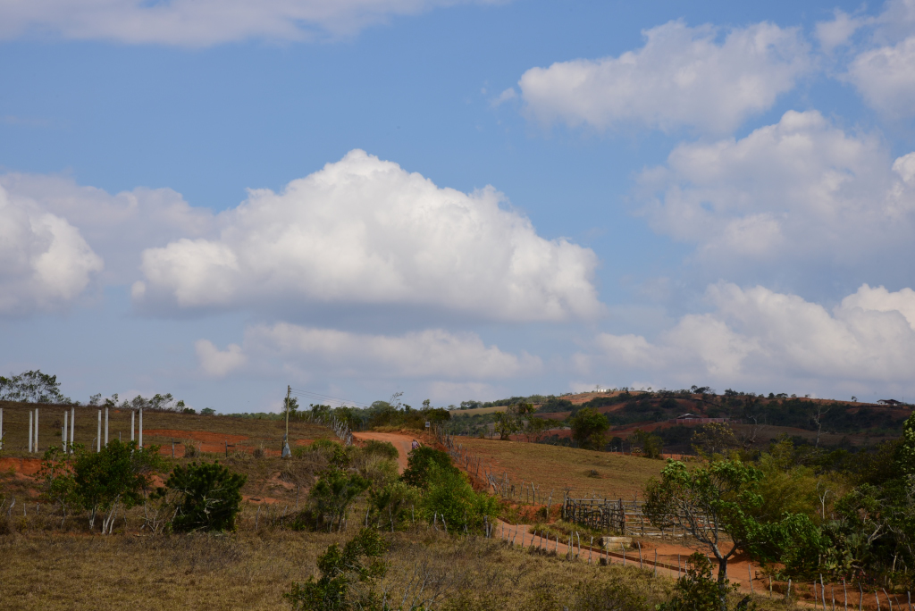
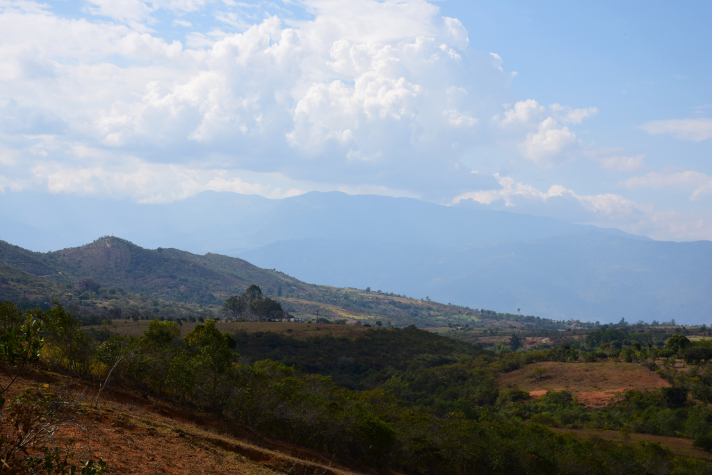
The landscape may appear dramatic in an absolute sense, but tepid relative to the typical drama of the Colombian highlands. Steep hills define the limits of the topographical contours of the landscape, with no apparent dramatic drops or soaring peaks. Given the high elevation and dry climate, I see no evidence of tropical vegetation, the greenery at best Mediterranean in nature. Succulent-style plants abound, which would suggest a dry climate. Again, the lack of organized cultivation imparts the area bordering the narrow road with an almost random, chaotic quality. Nor is any of land dedicated to grazing animals, given that I see no open grassland nor domestic animals of any sort.
Villanueva to Cañón del Chicamocha
Villanueva to Cañón del Chicamocha
Villanueva to Cañón del Chicamocha
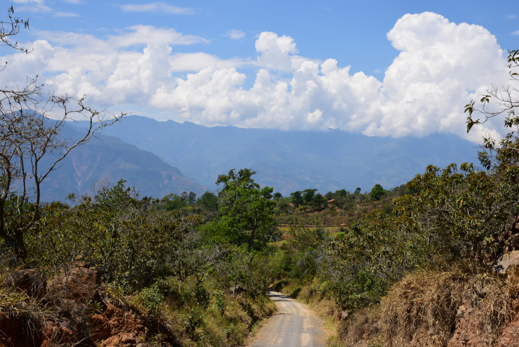
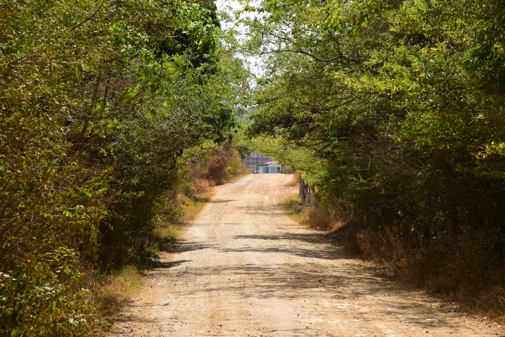
The road is narrow, weaving around and over the shallow uneven hills, gradually arcing or suddenly bending, at times lined by crumbling stone walls, at times passing houses, some new, some decrepit. The beauty of the walk is largely experienced in the ever-changing sight lines that unfold around me, the road rising in elevation as on a wave on the sea, and the land opening up to witness the afternoon sun glimmering on the crests of the rolling hills in the distance. Dogs bark as I pass houses, the barking quickly dissipating when it becomes apparent I have no intent of approaching the house in question.
Villanueva to Cañón del Chicamocha
Villanueva to Cañón del Chicamocha
Villanueva to Cañón del Chicamocha
The sun has advanced across the sky, and the earthen hues of the surrounding landscape now richer in the late afternoon sun. I trudge ahead, one foot ahead of the next, anxiously wondering when the canyon that Jordan is alleged in is supposed to appear. I was assured that the walk wouldn’t be that long – and yet I can’t imagine accessing the canyon being such a minor affair. And yet: Where is the canyon? As before, I encounter very few along the road, but those I do meet assure me that I am on the right track.
Villanueva to Cañón del Chicamocha
Villanueva to Cañón del Chicamocha
Villanueva to Cañón del Chicamocha
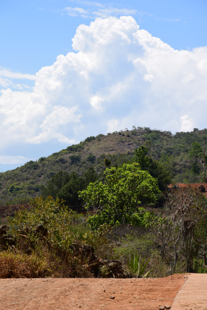
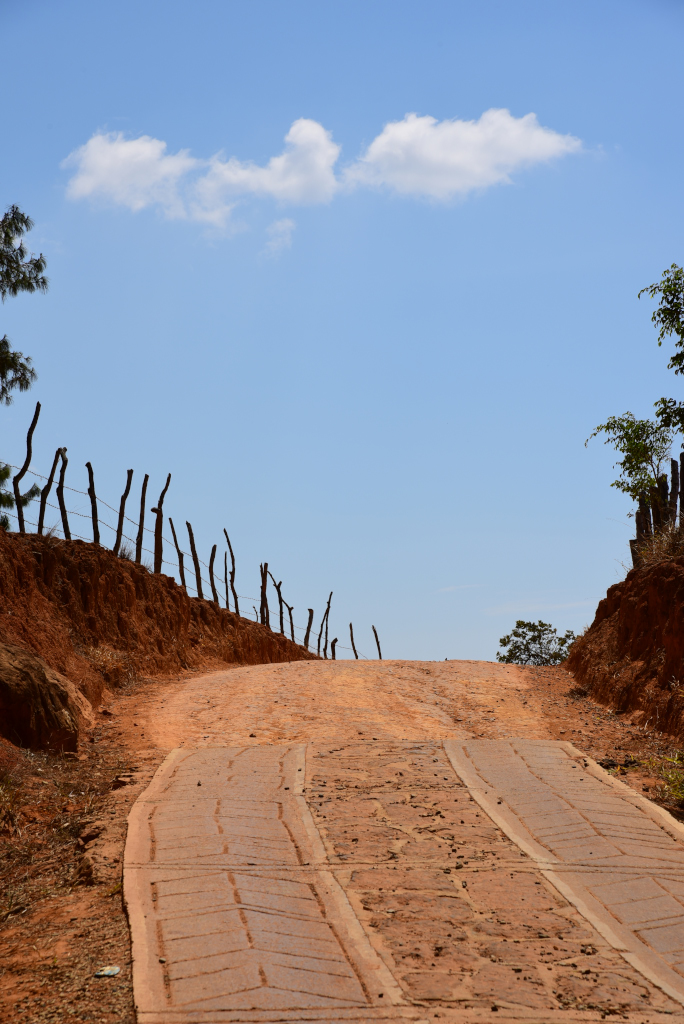
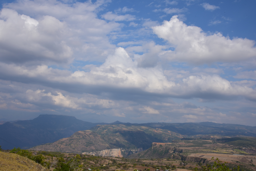
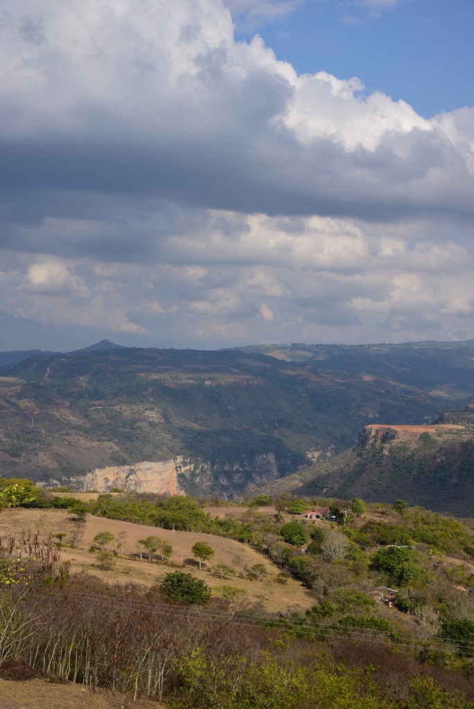
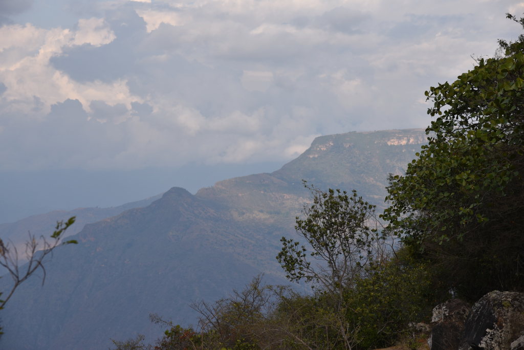
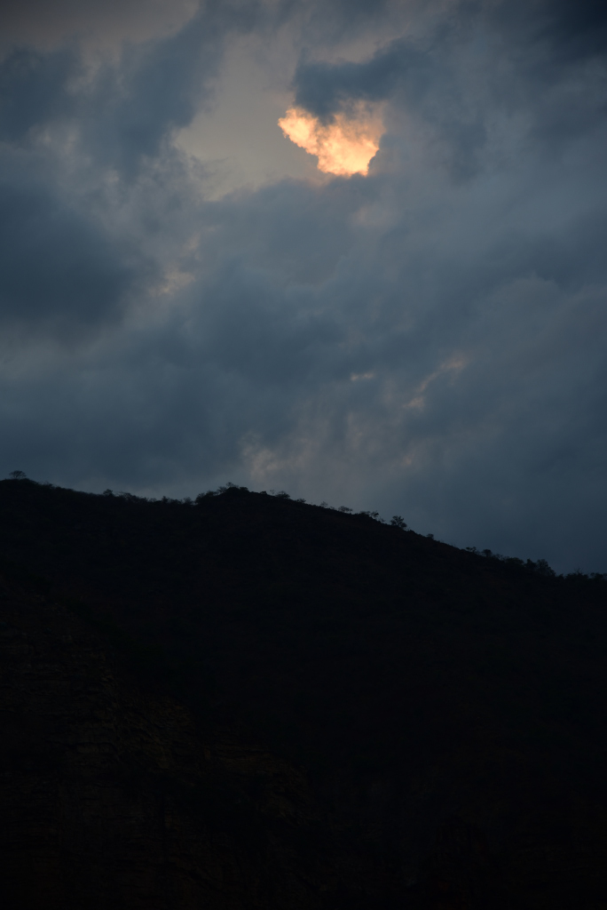
When the road crests a hill, the sky reveals itself, crowned with stunning cumulus formations against the cerulean splendor of the Santander afternoon. The rolling, dry highland countryside is geographically deceptive, inasmuch as not far to the north, the Chicamocha canyon marks a deep gash across the region, running eastward into the Cocuy mountains, the high alpine ridge located on the eastern central flank of Colombia before dropping into the tropical basin of the Orinoco river and Venezuela further to the east. North of the canyon, the highlands return to their splendor, but only briefly before descending dramatically into the subtropical basin of the great Magdalena river that defines the northwestern boundary of the mountain state. Further north, nothing but blazing hot, rolling savanna interrupted by vast swamp systems, growths clinging to Colombia’s mighty Magdalena, Cauca and Sinú rivers on their inexorable descent to towards the waters of the tropical Caribbean.
Villanueva to Cañón del Chicamocha
Villanueva to Cañón del Chicamocha
Villanueva to Cañón del Chicamocha
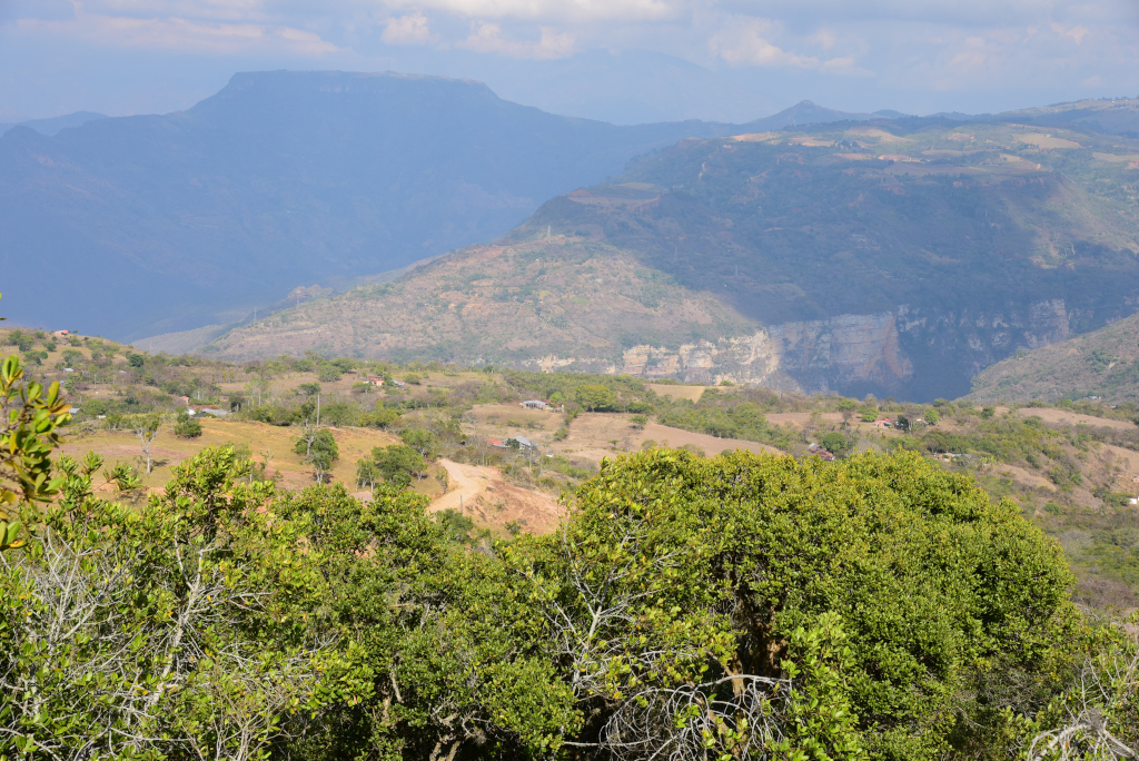
And then I see it – in the distance, nestled in the rolling, dry landscape ahead of me, beneath a sea of now thickening clouds, the Cañón del Chicamocha, still a crack in the landscape, ever-so-slowly easing open as the road winds forward. And now increasingly visible, stunning, dramatic, and breathtaking, and yet I am still quite far away from the lip, having little idea from my distance as to how deep it is. Around the bend of the last hill, the road progresses along a flattening plane into a cluster of modest houses where I am assured that there is one last shop I can buy drinks and snacks in before continuing into the canyon. The owner brusquely informs me that the descent into the canyon is no minor affair, and will take hours – but doesn’t prepare me for the enormity of the descent, nor its steepness – nor that the fact that I am at risk of finding myself somewhere along the cliff in the approaching darkness.
Villanueva to Cañón del Chicamocha
Villanueva to Cañón del Chicamocha
Villanueva to Cañón del Chicamocha
With two large bottles of pop in my pack – the worst options for rehydrating – I hurriedly continue on to meet my fate. On to the lip of the canyon, then down. But the lip doesn’t seem to materialize, as I descend along a feral country lane, then along a succession of shallow plateaus, the road degenerating into a trail that takes me into a private property, the trails splitting around a small house, and behind – nothing, nothing but emptiness. But where does the trail descend? At the edge, I see goats cavorting in a maze of loose stone wall-enclosed, overgrown paths, zig-zagging downwards. But how do I even get into the maze? And where does the path continue downwards after that?
Villanueva to Cañón del Chicamocha
Villanueva to Cañón del Chicamocha
Villanueva to Cañón del Chicamocha
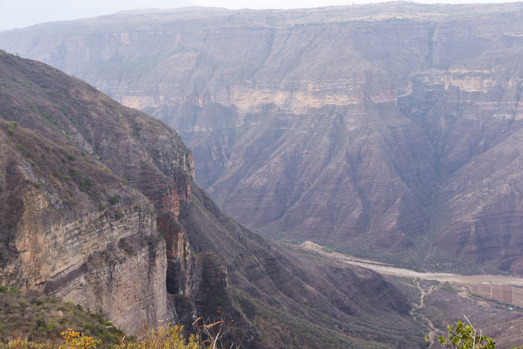
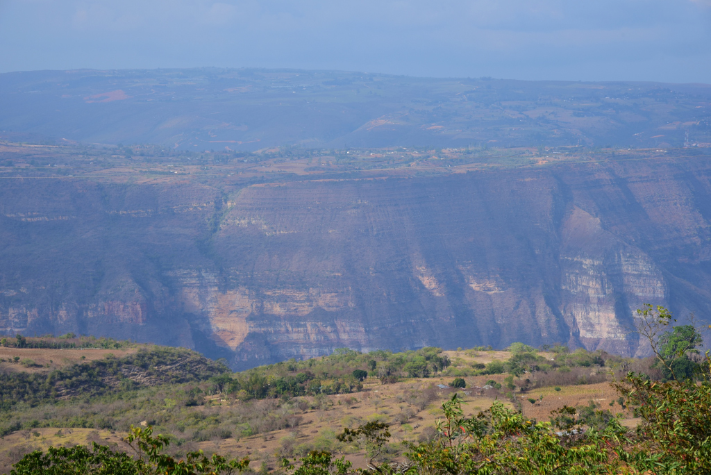
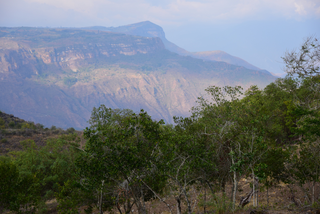
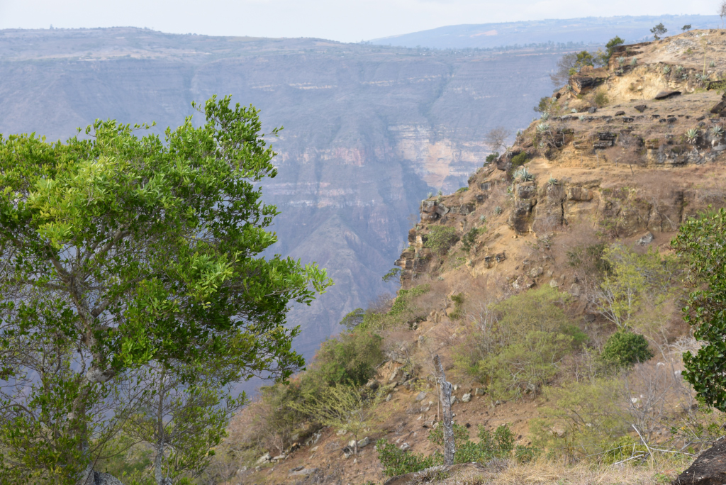
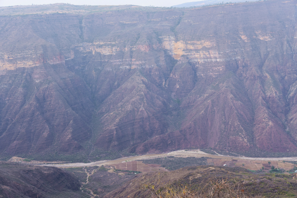
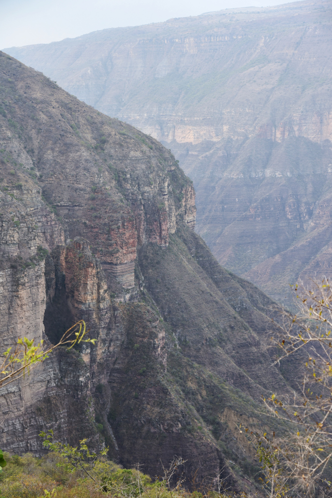
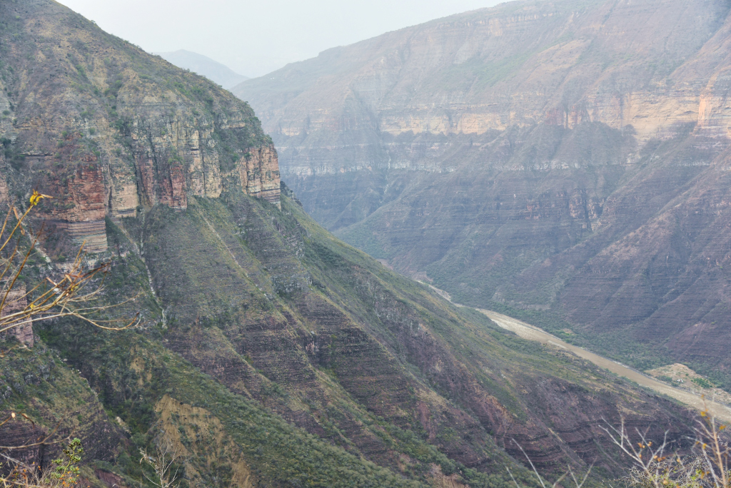
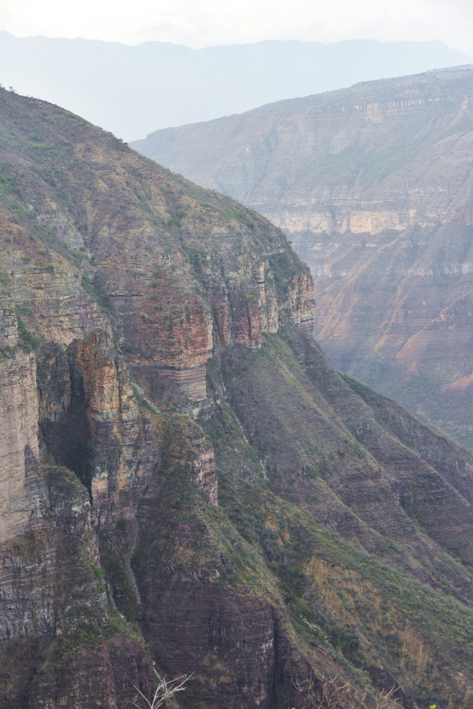
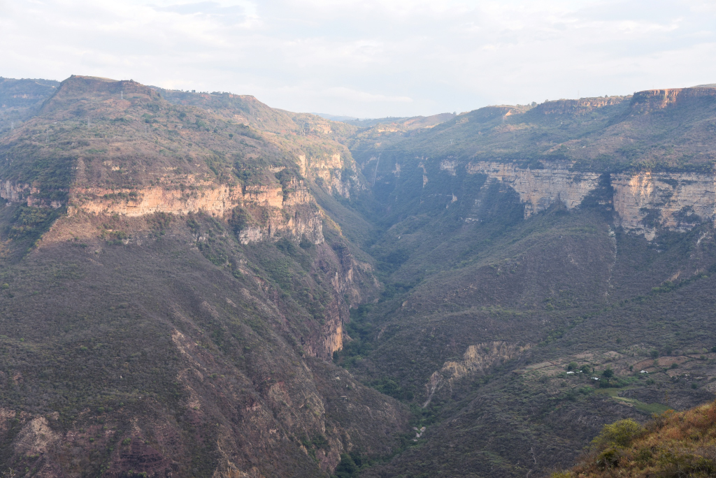
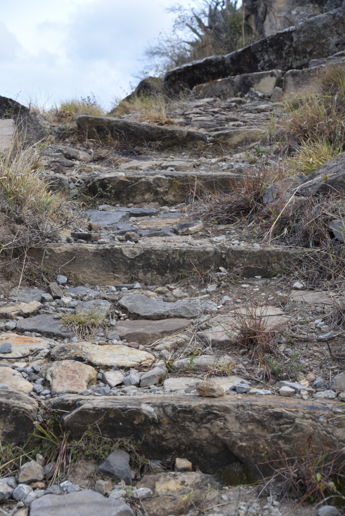
And there it is, finally, a rough dirt path that runs along the edge of the cliff, undergrowth happily not occluding its progress. At least there is no risk of getting lost once I am actually descending, given that there is only way, and that’s down. And falling? Happily, the trail seems wide enough to not lose my footing, at least this high up. The trail winds dizzyingly back and forth below me, quickly disappearing into the abyss, and around me, a massive gulf opens up, the enormous cliff faces so deep I can’t make out the bottom of the canyon, and so far away that they are bathed in haze.
Cañón del Chicamocha
Cañón del Chicamocha
Cañón del Chicamocha
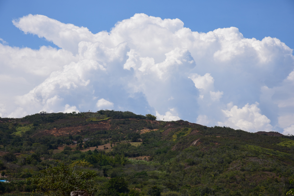
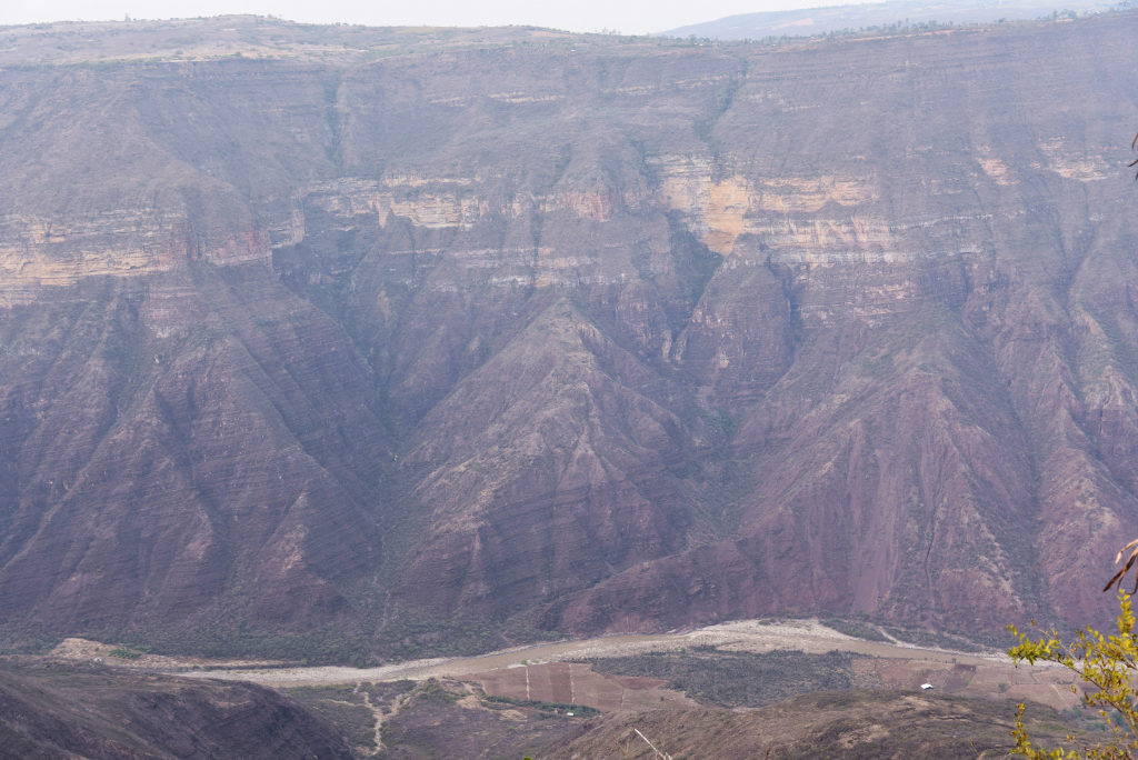
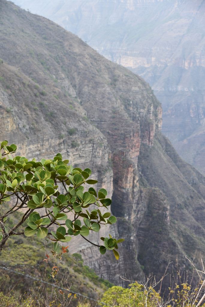
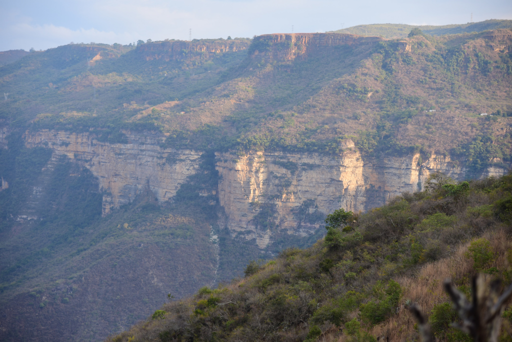
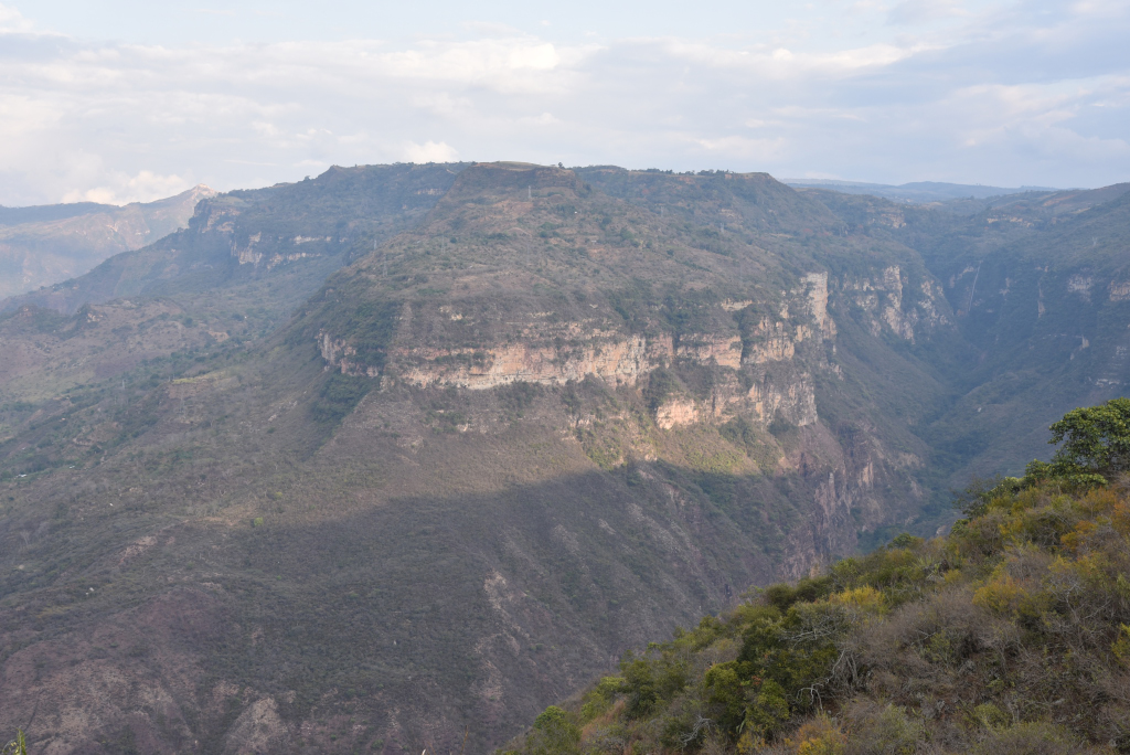
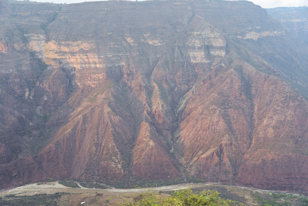
The enormous walls of the canyon drop off before me, stark, mostly bereft of any vegetation, vast in scope and a shock coming from the rolling, benign countryside nearer Barichara. Who could have imagined! And then I see it, the river snaking along the bottom of the canyon, flanked by a meager patchwork of agriculture and mostly overgrown land below masked by thick haze, the steep cliffs losing their disciplined verticality further below, evolving into thick ridges that flow lava-like towards the base of the valley.
Cañón del Chicamocha
Cañón del Chicamocha
Cañón del Chicamocha
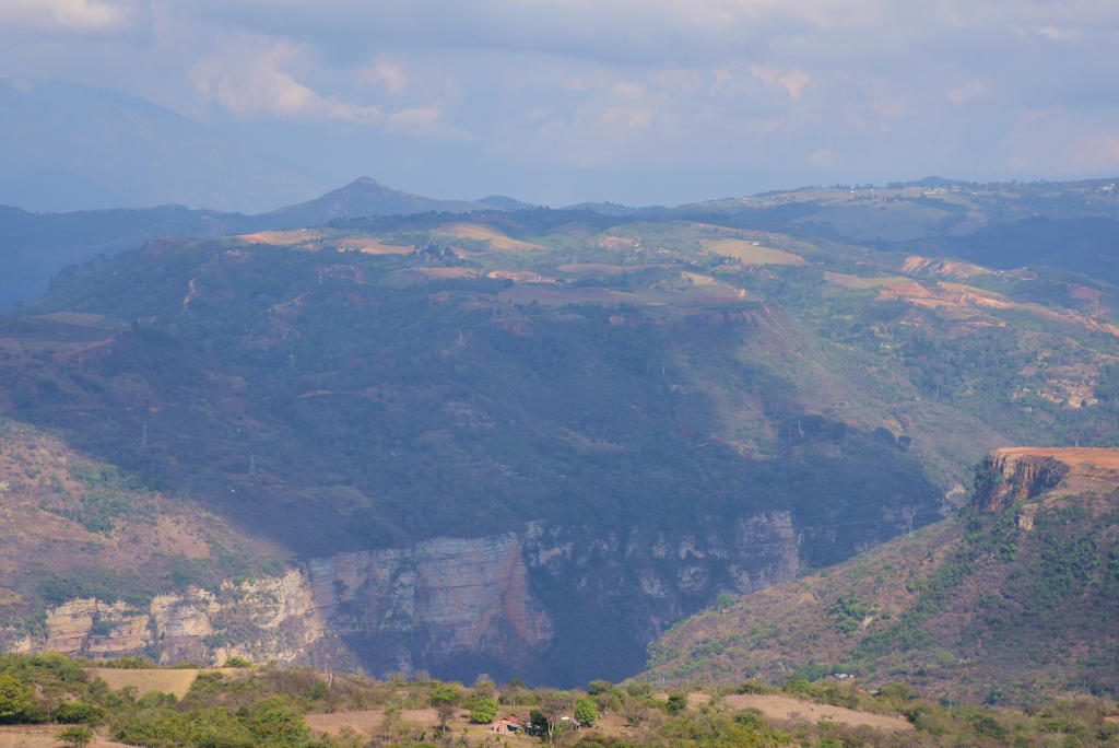
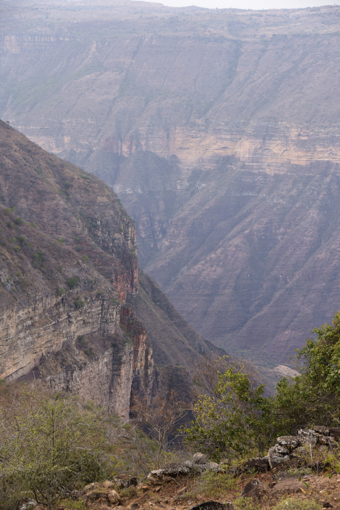
I zig and I zag, following the path back and forth, happily to finally be on what appears to be the final leg of the trail, although increasingly concerned from the view of the dramatic vista before me that my elevation doesn’t seem to be changing. Every turn I make, every leg of the path I descend seems to have no discernable impact on the height of those daunting cliffs.
Cañón del Chicamocha
Cañón del Chicamocha
Cañón del Chicamocha
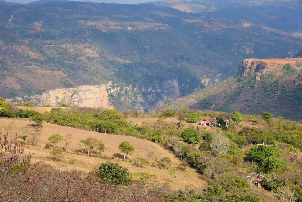
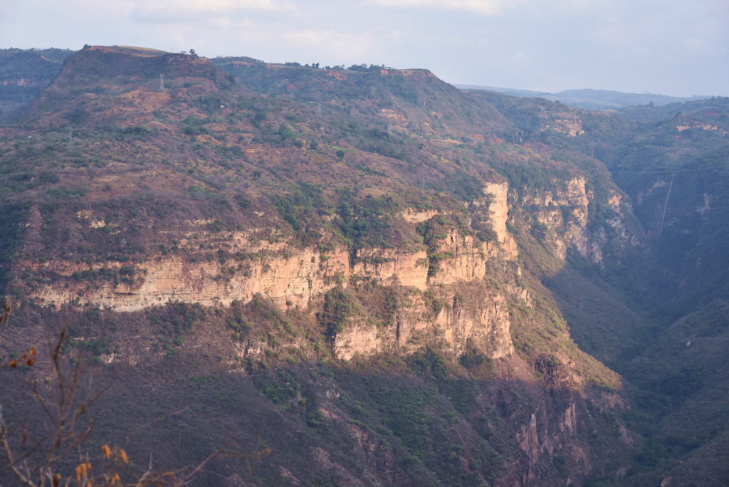
Covering an area of 108,000 hectares over a length of 227 kilometres, with a maximum depth of 2,000 metres, the Cañón del Chicamocha is the second-largest worldwide. The canyon is situated in the departments of Boyacá and Santander, stretching from Soatá in the southeast to Girón and Betulia in the northwest. On the eastern flank of the canyon lies the Parque Nacional del Chicamocha, through which runs the highway from Duitama to Bucaramanga, the main road running through Santander province.
Cañón del Chicamocha
Cañón del Chicamocha
Cañón del Chicamocha
The canyon was formed in a period about 30 million years ago, traversing formations ranging from the Precambrian to the Pleistocene ages. The southern extension near Soatá contained a Pleistocene paleolake, Lake Soatá, where fossils of the period have been found. The canyon is the result of the erosion caused by the Chicamocha River, which has resulted in steep cliffs on both sides. The Chicamocha Canyon begins near the town of Soatá in the Department of Boyacá and flows mainly through Santander, extending all the way to the municipality of Lebrija.
Cañón del Chicamocha
Cañón del Chicamocha
Cañón del Chicamocha
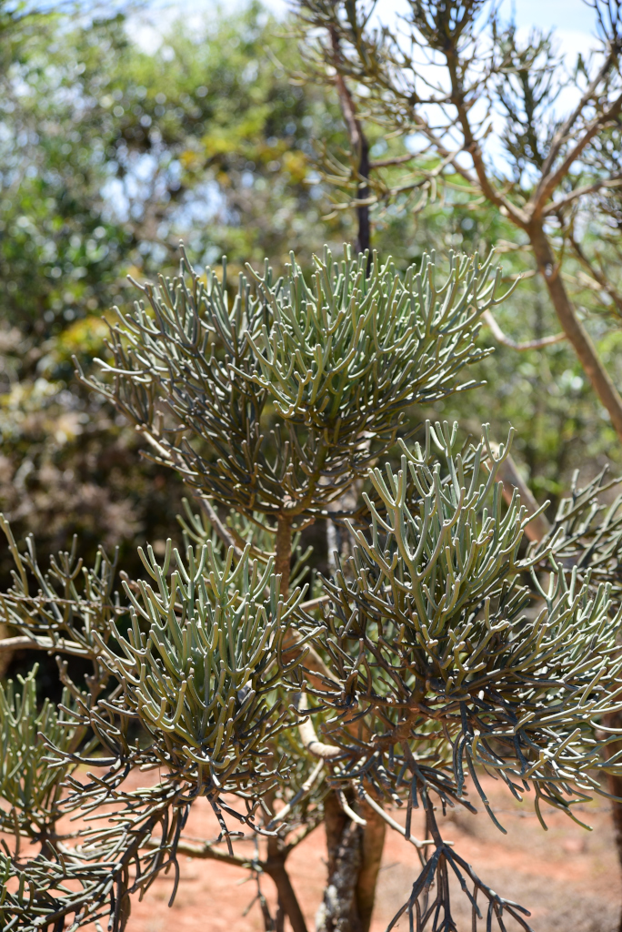
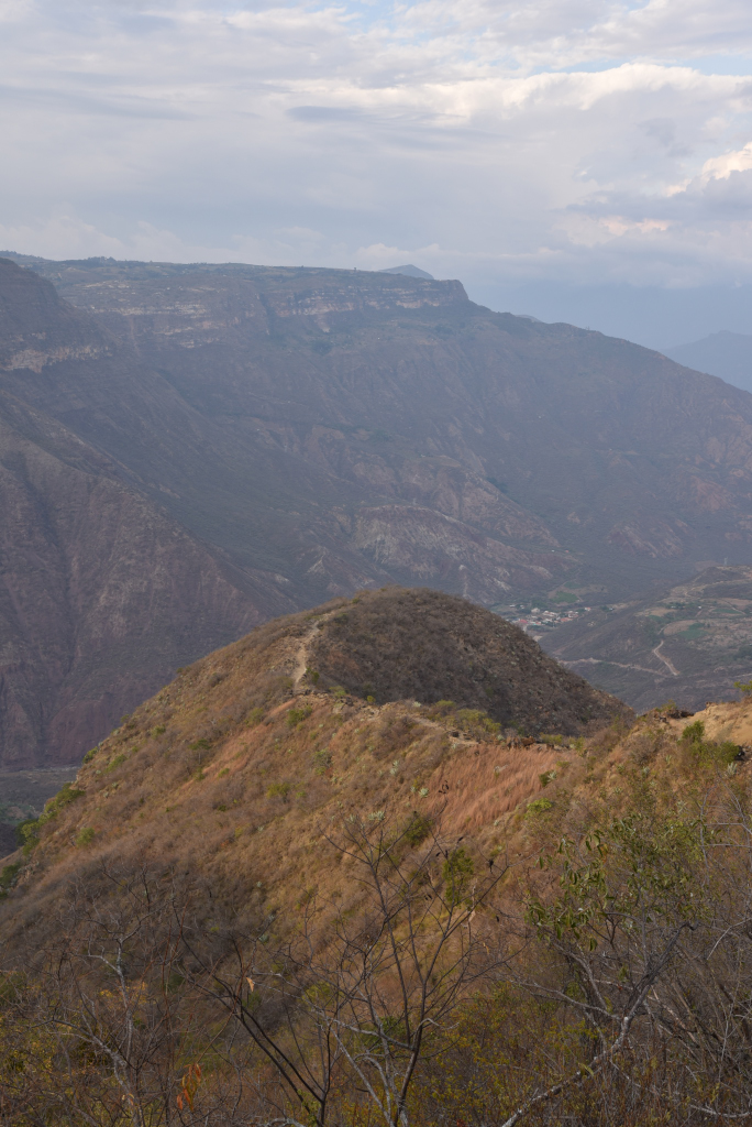
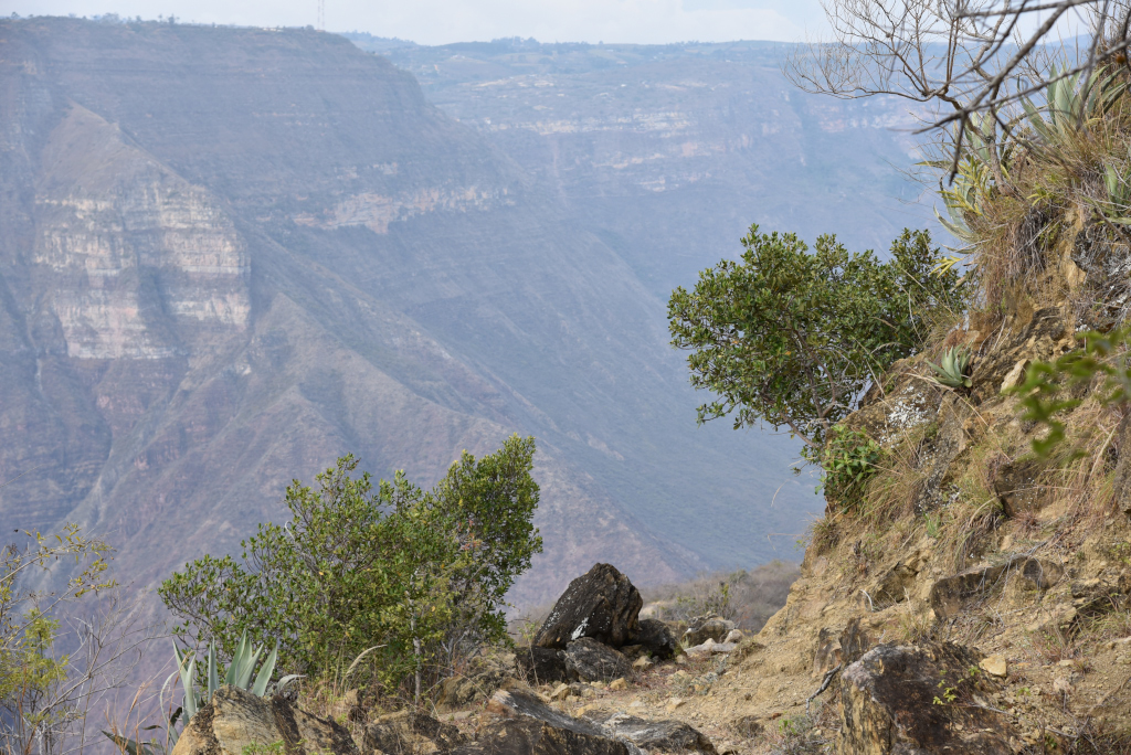
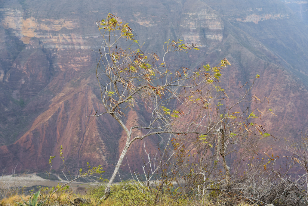
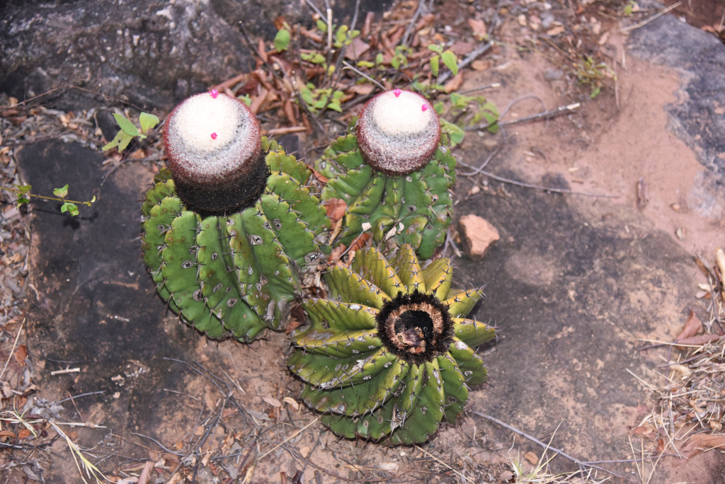
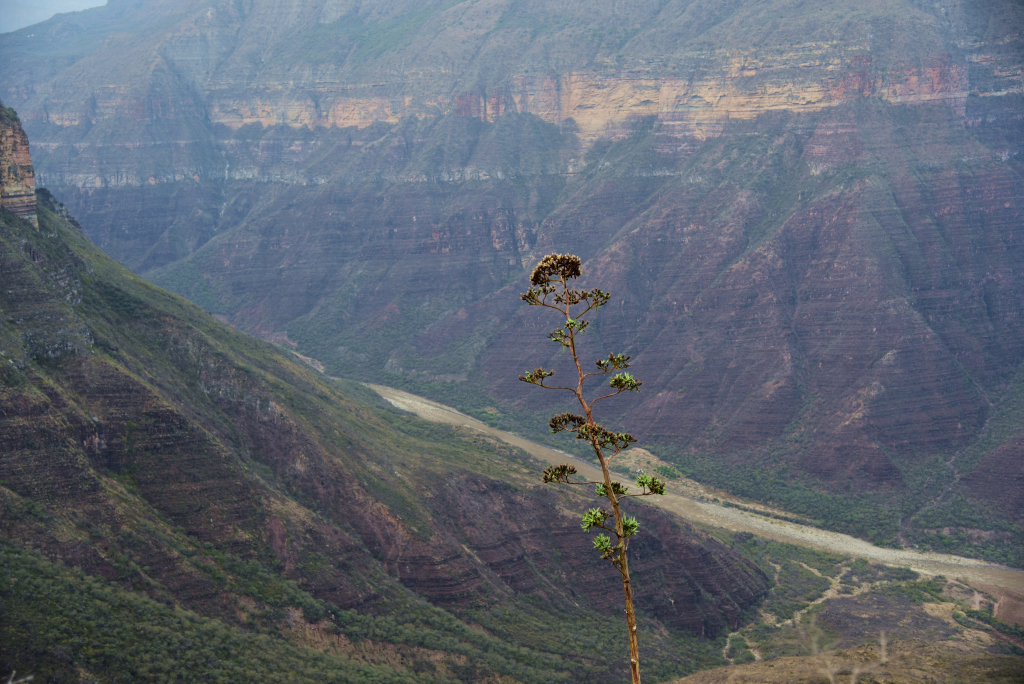
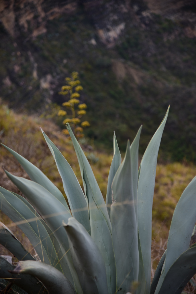
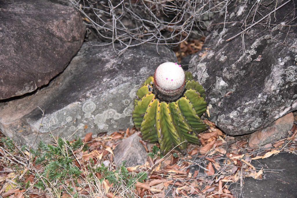
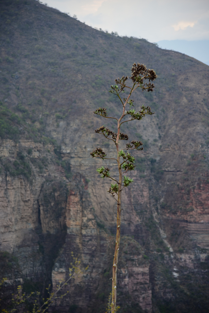
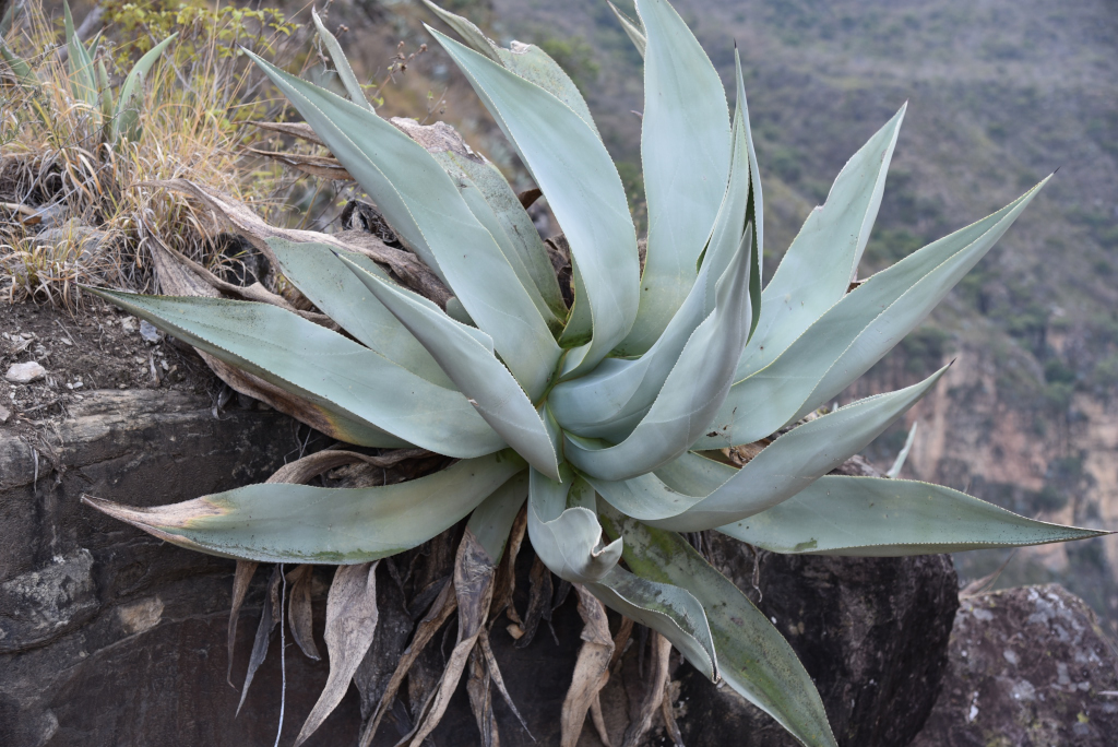
Spectacular vistas of the canyon unfold as I continue down the steep gravel trail, the contours and angling of canyon walls moving in and out of focus, the valley bottom finally emerging from the gloom. The heights I have descended from have disappeared in the shrubbery and rock outcroppings far above. Courageous trees and gigantic aloes emerge from rocky outcrops, the stark rocky setting far more fecund than the distant vistas suggest, the cliffside rich in grasses, small bushes and exotic cactii.
Cañón del Chicamocha
Cañón del Chicamocha
Cañón del Chicamocha
Cañón del Chicamocha
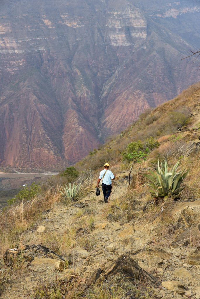
Below me, an enormous ridge comes into focus, closer, closer, and then at its crest, no longer descending, but walking on relatively level ground to its end prior to the trail winding downwards again into the now approaching valley. The afternoon seems to be holding up so far, the light not yet diminished. I have been alone the entire time on the descent, and yet now a man passes me on the trail and rushes onward, quickly reaching the end of the ridge before vanishing from sight. When I reach the edge of the promontory and scan the horizon around me, he is long gone, the enormity of the distance I still have to cover becoming apparent.
Cañón del Chicamocha
Cañón del Chicamocha
Cañón del Chicamocha
Cañón del Chicamocha
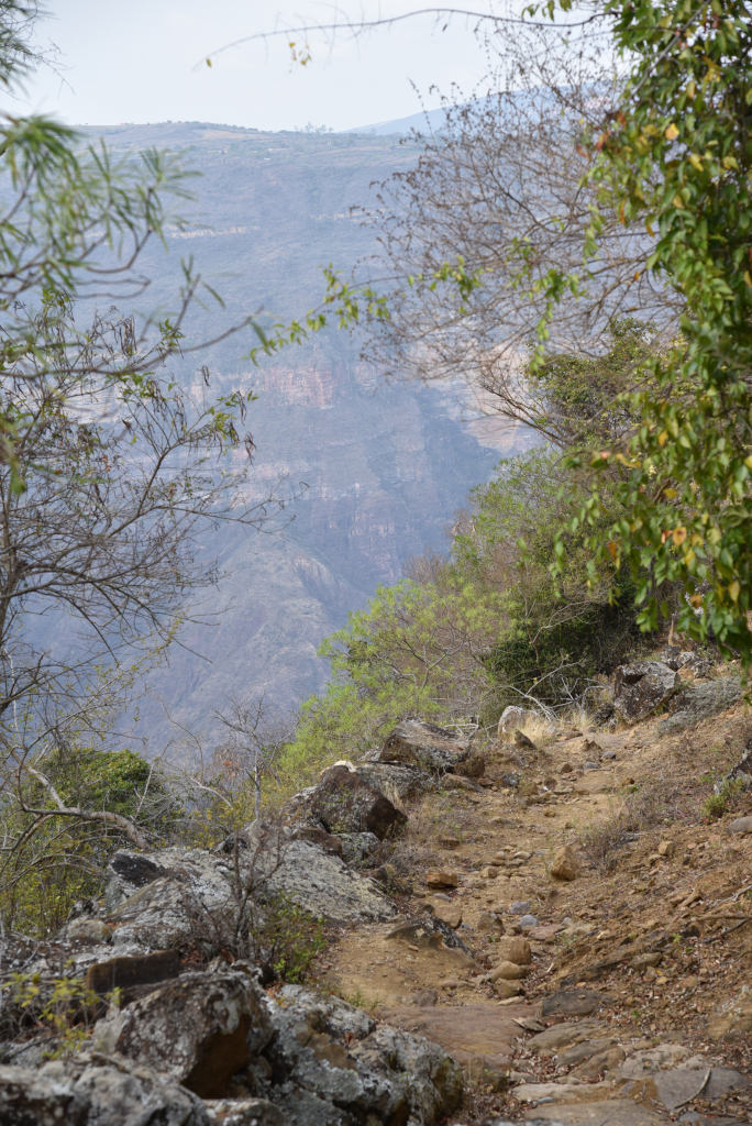
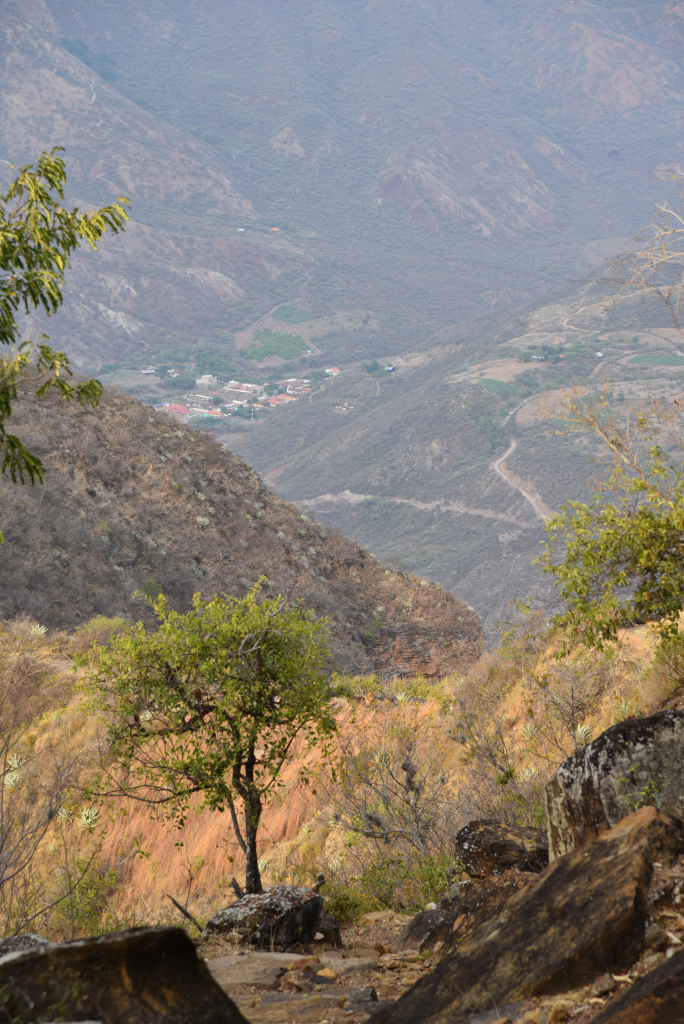
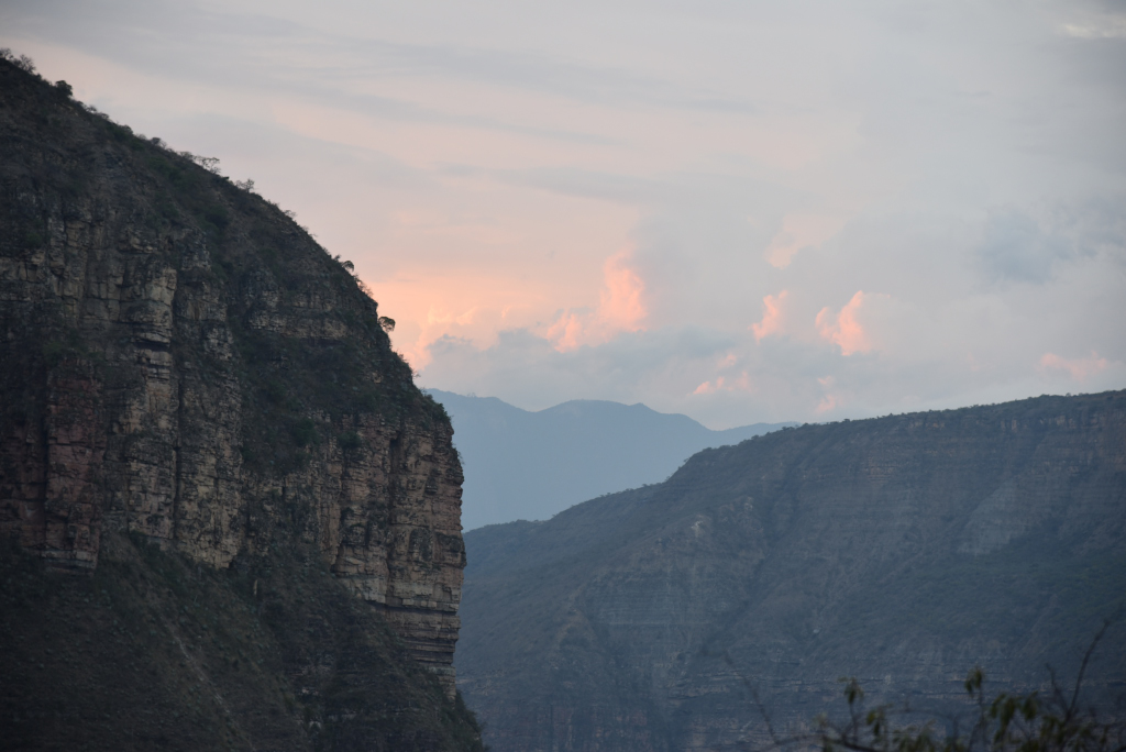
Increasingly, the trail is flanked by exotic cactii and the huge aloe plants, with their tall, slender flowers, at times fresh, at times withering. I would love to spend more time admiring the beauty of the vegetation on the arid canyon walls, but the light is now falling, and I still have a very long way to go. I become increasingly anxious, realizing that I am in one of the remotest areas in central Colombia, completely alone, nowhere near any sign of civilization, scattered houses far below me and possibly still several hours away. I nervously grip my pocket flashlight, praying the batteries won’t give out, only lighting it once the natural light has dissipated entirely and visibility has been reduced to nothing. And now in the darkness I have another fear – venomous spiders, snakes or scorpions that may feel emboldened in the night.
Cañón del Chicamocha
Cañón del Chicamocha
Cañón del Chicamocha
Cañón del Chicamocha
Exhausted, parched, and shaken, I stumble through the darkness, desperately hoping my flashlight battery doesn’t die. And thankfully it doesn’t let me down, the hypnotizing back and forth, back and forth now following broader returns, signalling a leveling out of the trail. The houses I had seen in the distance deep below me morphed into distant lights, although in the darkness I had little sense of gauging how close or far they were. Back and forth, back and forth, the laps shallower and shallower, and then suddenly over the last pile of rocks, a short hop – and I am on a road, the lights of a few houses visible in the darkness not far from where I stand. I am overcome with relief and gratitude, although in reality I may be nowhere near the place I was supposed to be staying.
Cañón del Chicamocha
Cañón del Chicamocha
Cañón del Chicamocha
Incredibly, as I approach the first lit house and tepidly ask the inhabitants where I may find Shangri-La, they point me along the dark road: I need only continue a short distance, then turn off onto a side road, then continue downhill. Following their instructions, I panic again, as the darkness envelopes me and I seem to be continuing pointlessly, no evidence of any living quarters emerging. No, a lit house does appear, but it is not the place I am looking for.
Cañón del Chicamocha
Cañón del Chicamocha
Cañón del Chicamocha
Attempting to quieten his guard dogs, the man explains that I am actually on the correct road, I need only continue a short distance further, and he will call the guardian to ensure that I am greeted at the gate. And finally, there it is, a locked gate blocking the road with a hand-painted sign announcing “Shangri-La”, further down the trail a figure emerging from the shadows to greet me, unlock and open the gate, and beckon me to follow him further into the darkness towards the river where the lodge is located in what will turn out to be a stunning setting, and that will be one of the highlights of my stay in Colombia.
Cañón del Chicamocha
Cañón del Chicamocha
Cañón del Chicamocha